
























Mukono Municipality has started marking its boundaries with neighbouring local governments, a process that has revealed several areas and revenue-generating facilities that were previously managed by other authorities.
The exercise, conducted with neighbouring Mukono District and Kira Municipality in Wakiso District, has identified factories, schools, petrol stations and other properties in areas that municipal officials say fall within Mukono Municipality.
One of the notable findings is Zinga Island in Lake Victoria, which officials said had previously been understood to fall partly under Mukono District and Wakiso District.
However, the boundary-opening exercise has established that the island is within Mukono Municipality.
Henry Makumbi, the Mukono District Surveyor, said the technical team used boundary data obtained from the Ministry of Lands.
He said the data provides the official basis for determining the municipality’s boundaries and cannot be altered arbitrarily.
According to Makumbi, markstones have been installed at intervals of about 500 metres to clearly indicate the municipal boundary.
The stones are painted white and bear the initials “MMC”, representing Mukono Municipal Council.
Christopher Mutumba, a law enforcement officer in Mukono Municipality’s Physical Planning Department, said the exercise has enabled the municipality to identify major revenue-generating properties that had previously been administered by neighbouring local governments.
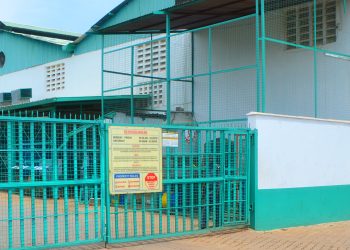
He cited Igar Petrol Station, Nam-ruth Secondary School and several factories among the properties identified during the exercise.
Mutumba said the boundary markers will also help municipal technical teams determine the areas under their jurisdiction when planning, enforcing physical development regulations and collecting revenue.
However, he said some of the boundary markers have divided major factories, with portions of the same establishments falling under different local government jurisdictions.
Francis Byabagambi, the Mukono Municipal Town Clerk, said local governments would have to harmonise revenue-collection arrangements in cases where developments straddle administrative boundaries.
He said trading licence fees are paid to the local government where a business’s offices are located.
“Boundary marking is important; we have had some collisions in collecting revenue where entities have been raising concerns of extending to their premises and vice versa. But now all this has come to an end,” Byabagambi said.
Robert Peter Kabanda, the Mukono Municipal Mayor, described the exercise as long overdue, saying the absence of clearly marked boundaries had affected the municipality’s control over some strategic areas.
He cited a location along the Lake Victoria shoreline that can be accessed through Ssenyi-Degeya in Goma Division, saying the area could be important for future development.
Kabanda said the municipality would also identify areas lacking essential services and communicate the needs to the central government.
“In many areas that had been previously left behind, services that are still needed and we are going to let the government know about them,” he said.
Humphrey Kyasa, the Goma Division Chairperson, said local leaders had for years pushed for the boundaries to be clearly established, particularly because of disputes over property tax with neighbouring local governments.
He said the exercise would help the municipality recover areas that had previously been left outside its effective administrative control and increase locally generated revenue.
“The essence of this is to hike the revenue and make a rejoin of our parts that were lost. These are some of the lost areas that have been found,” Kyasa said.
He also called for improved road access to the Lake Victoria shoreline, saying this could reduce transport costs and create opportunities for recreation and other economic activities.
The boundary-marking exercise is expected to provide a clearer basis for physical planning, revenue collection and service delivery within Mukono Municipality while reducing jurisdictional disputes with neighbouring local governments.